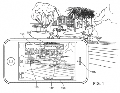
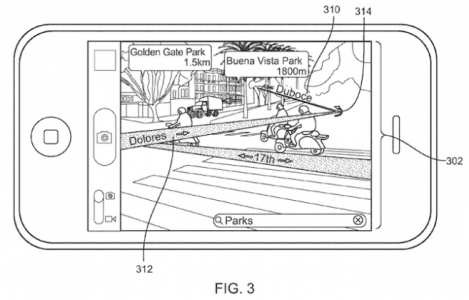
Apple engineers are working hard to develop new technologies for the Cupertino company, and now we have a patent that shows Apple's interest in improving the iOS Maps application by adding augmented reality. Apple's implementation would take augmented reality technology one step further providing users the possibility to see video content directly over the information about the location where it is located. Of course, the application would display information about the surrounding points of interest directly above the information about the street, the name of the street, etc., and in addition, Apple has also designed an innovative system for alerting users when they go in the wrong direction.
The handheld communication device visually augments the captured video stream with data related to each point of interest. The user then selects a point of interest to visit. The handheld communication device visually augments the captured video stream with a directional map to a selected point of interest in response to the user input. In one form of interaction, a device can receive input from the user requesting directions from a present location to a selected search result. Directions can be overlaid onto the currently displayed video feed, thus showing a course and upcoming turns.
The information provided by Apple would be taken directly from the application's database and, in addition, it would have a much simpler and more efficient method of displaying street names/points of interest. What Apple is proposing is not really new, some applications have been using similar technologies for some time, but something like this implemented directly in the iOS Maps application would definitely bring a big plus for iDevice users. Of course, everything is just an invention for now, but I for one would be very happy to find something like this in iOS.


