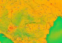
The weather in Romania for the next 2 weeks is revealed to us by ANM, the National Meteorological Administration, in a weather forecast published on February 26, 2024 by meteorological experts for all regions of our country, as you can see below.
The weather forecast in Romania issued by ANM shows us how the weather will evolve in all regions of the country, from Banat to Moldova, so that we know what to expect, if we intend to travel anywhere in the country in the following weeks.
ANM weather forecast with the weather in Romania in February and March 2024
grief
The calendar winter will end with particularly warm weather for this period, with maximums that will remain at an average of 18 degrees and minimums that will oscillate between 6 and 9 degrees. In the first two days of March, the daily average maximum temperature will be 16 degrees, it will return to 18 degrees on March 3 and 4, then values around 13 degrees are expected.
The minimum temperatures at the beginning of March will be on average 5...7 degrees, but towards the end of the first decade, as in the case of the maximum temperatures, there is a decrease to values of 2...3 degrees. Chances of precipitation will be higher after March 5th. Until then, the rainfall regime will remain deficient, the rains will be weak and in limited areas.
CRIŞANA
The calendar winter will end with particularly warm weather for this period, with maximums that will remain at a daily average of 19...20 degrees and minimums that will oscillate between 5 and 7 degrees. In the first days of March, the average daily maximum temperature will be 16...17 degrees, and after March 5, values around 13 degrees are estimated.
The minimum temperatures at the beginning of March will be on average 5...6 degrees, but towards the end of the first decade, as in the case of the maximum temperatures, there is a decrease to values of 1...2 degrees. The probability of precipitation will be higher after March 5. Until then, the rainfall regime will remain deficient, the rains will be weak and in limited areas.
TRANSYLVANIA
Daytime temperatures will remain well above climatological normal until early March (March 3), with a daily average maximum temperature between 15 and 18 degrees.
Afterwards, the tendency will be a gradual decrease, so at the end of the first decade, an average maximum temperature of 11...12 degrees will be reached, but these values will also characterize warmer weather compared to the period's normal.
The average minimum temperatures will be 3...4 degrees in the first night, it will drop to 0 degrees on February 28, and at the beginning of March it will rise to 2...3 degrees. After March 5, average minimum temperatures of 0 degrees are expected. No precipitation is forecast until March 1. Later, precipitation is possible, with a higher probability after March 6.
MARAMUREŞ
The weather will be extremely hot in this region as well, where the maximum temperatures forecast until March 1 will be around 18 degrees. Afterwards, the tendency will be a gradual decrease, from values on average of 16 degrees between March 2 and 4, up to 12 degrees at the end of the first decade.
The average minimum temperatures will be 4...5 degrees in the first two nights, it will drop to 2...3 degrees on February 28 and 29, and at the beginning of March it will rise to 5...6 degrees.
Until the end of the first decade, as in the case of maximum temperatures, a decrease in temperatures during the nights is also estimated, up to a regional average of 0 degrees. No precipitation is forecast until March 1. After that, the probability of precipitation will increase.
MOLDOVA
During the entire interval, the thermal values will remain above normal
climatological of the period. Between February 26 and March 3, the daily average of maximum temperatures will be 13...14 degrees, then generally values of 9...10 degrees are forecast.
The minimum temperatures will not have significant variations from one day to the next, their average, to be between 0 and 3 degrees. The rainfall regime will generally be deficient. Precipitation probability will increase after March 6.
DOBROGEA
For the first week of the forecast, the daily average of the maximum temperatures will be 12...13 degrees, and for the second it will be around 10 degrees, values that will characterize a still warm weather for this period.
The average minimum temperatures will drop slightly in the first nights, to values of 2...3 degrees, on February 29, March 1 and 2 it will be 4...5 degrees, then it will return to 2...3 degrees. The rainfall regime will generally be deficient. Precipitation probability will increase after March 6.
MUNTENIA
On February 26, the regional average maximum temperature will be 18 degrees, and in the following days (until March 4) it will be around 15 degrees. Between March 5 and 10, lower maximum temperatures are estimated, with an average of 11...12 degrees.
The average minimum temperatures will drop slightly in the first nights, to values of 1...3 degrees, on February 29, March 1 and 2 it will rise to 4...5 degrees, then it will be 1...2 degrees. Chances of precipitation will be higher after March 6. In the rest of the interval, rains are possible only in limited areas.
Olten
Daytime temperatures will remain well above climatological normal until early March (March 4), with a daily average maximum temperature between 14 and 17 degrees.
Afterwards, the tendency will be a gradual decrease, thus at the end of the first decade an average maximum temperature of 11...12 degrees will be reached, but these values will also characterize a warmer weather than normal. The average minimum temperatures will be 5...6 degrees on the first night, it will drop to 3 degrees on February 28, and at the beginning of March (March 1 and 2) it will return to
5...6 degrees.
After March 3, average minimum temperatures between 2 and 4 degrees are expected. In this region, the probability of precipitation will be higher on March 1 and 2 and between March 6 and 9.
IN THE MOUNTAINS
The average daily maximum temperature until the end of February will remain at 8 degrees. The calendar spring will begin with slightly lower daily temperature values, namely an average for the entire area of 6 degrees, and after March 5 it will gradually decrease to values around 2 degrees.
The evolution will be similar in the case of minimum temperatures, these
to have an average of 0...2 degrees in the first week and with a gradual decreasing trend to -4 degrees in the second week. Chances of precipitation will be higher after March 5th. Until then, the precipitation will be weak and will be reported in limited areas.


