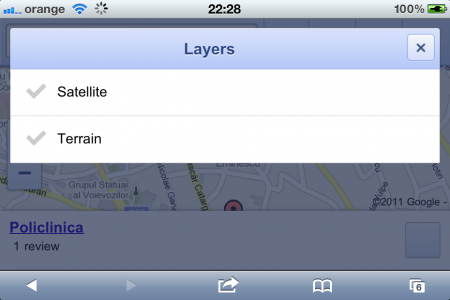
Today Google has updated the mobile version of the maps.google.com website to include in the web application a good part of the options already available in the dedicated iOS and Android applications. The new version of the web application from maps.google.com can now locate us on the map using GPS coordinates directly in Safari, it can give us navigation directions to a certain point on the map regardless of the chosen travel method and it can display interesting places/locations from our area. Basically Google wanted to improve the user experience in using geolocation web services and from my point of view they managed to do this.
Here is what was implemented today in Google Maps for mobile:
- the possibility to view the current location;
- the possibility to search for places in our vicinity with the option to automatically complete the names;
- the introduction of icons for bus/tram stations or railway stations;
- the possibility of receiving directions for navigation to a location using: a car, a bicycle, a means of public transport or for walking;
- the possibility to display traffic information on the map or to see the "satellite" version of the map;
- the possibility to see recommended locations if you are logged in to your Google account.
Google has implemented a whole series of interesting things that are not even found in the native Maps application in iOS. You can try the new functions implemented by Google by navigating to maps.google.com using Safari in iOS.


![IMG_0214[1] | iDevice.ro](https://www.idevice.ro/wp-content/uploads/2011/05/IMG_02141.png)
![IMG_0215[1] | iDevice.ro](https://www.idevice.ro/wp-content/uploads/2011/05/IMG_02151.png)


