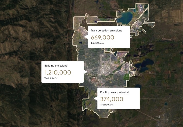
Google Maps is part of an amazing new feature launched by Google today, Americans are thinking of ways to give humanity the opportunity to know more about what is happening around it. More precisely, those from Google used the data from Google Maps, and a partnership with another company, to calculate the carbon footprint for several cities on the planet, the data to be extended to other cities soon.
Google Maps has integrated its data in a system called The Environmental Insights Explorer, Google collaborated with the Global Covenant of Mayors for Climate and Energy to create it. Thus, Google Maps helps people to understand much more easily which of the cities on the globe generate the biggest carbon footprint, i.e. pollute the most, and if Bucharest were there, it would probably be somewhere in the top of the most polluting world.
Google Maps: AMAZING Feature LAUNCHED by Google
In this new project, Google Maps also allows the differentiation of the carbon footprints generated by office or residential buildings, so that people can find out how much pollution each type of building produces. The idea of those from Google for Google Maps is a very interesting one, and it will certainly be appreciated by many people who until now could not know how much pollution can be generated by various types of buildings.
Google Maps has this functionality offered at a time when the pollution of the planet is no longer taken seriously by the US administration, so knowing how much pollution is produced there can be extremely useful. Google Maps has one special website where these new data can be viewed, so you will have to go there to see the information, as it is not available in the application for mobile terminals, or anywhere else, yet.


