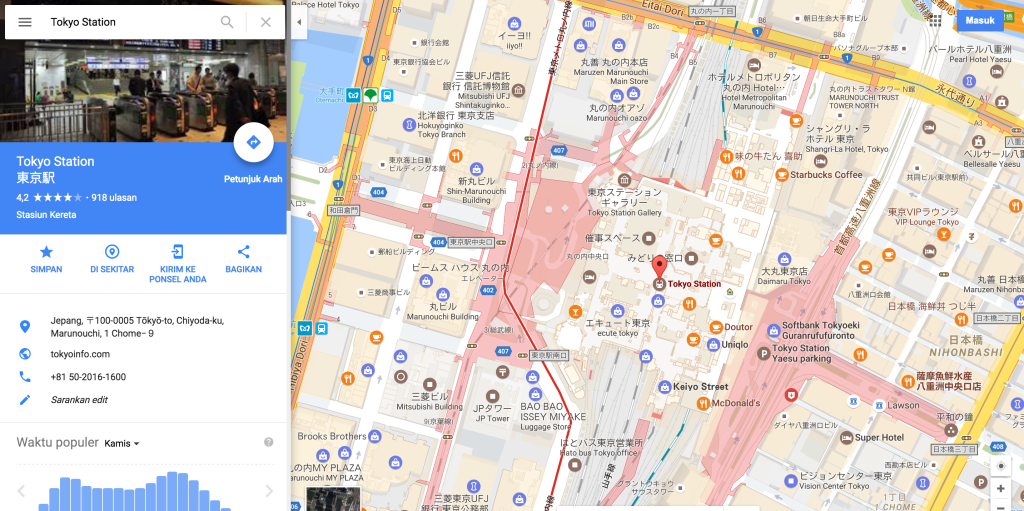
Google Maps has quietly implemented a new feature extremely useful for users from all over the world who use the platform, it now also displays maps for the interior of metro stations in some cities. Those from Google did not announce the new function for Google Maps in any way, so many were taken by surprise when they saw the maps with the inside of the metro stations.
Google Maps has been displaying maps of the interior of some buildings for some time, and now with the display of the interior of metro stations, things become even more interesting. A few cities in the USA and Asia have mapped some subway stations in Google Maps for now, but the company is expanding its coverage for others as well, possibly even reaching Europe in the not-too-distant future.
Google Maps displays maps of the interior of metro stations in some cities
For now, these maps from Google Maps with the interior of the metro stations are quite rudimentary, because there is no information about what is found in them. More precisely, Google Maps does not display information regarding the location from which travelers can buy tickets within Google Maps, or locations from which they can buy food, or how they can reach the platforms.
Considering that all these maps with the interior of the metro stations are just starting to appear in Google Maps, it is normal that the information is quite scarce for the time being. As Google expands the availability of maps with the interior of metro stations for various existing cities in Google Maps, much more information will appear for us.
Drawing a parallel between Google Maps and Apple Maps, it will be a long time before Apple will have maps with the interior of metro stations. Those from Apple are just starting to implement maps with the interior of buildings in Apple Maps, so Google Maps is years away from those from Apple, and this only makes our daily use more difficult.


