Google Maps. O noua functie grozava a fost implementata de catre compania Google in aplicatia pentru platforma de harti online, si cel mai probabil veni deveni dependent de ea dupa ce vei incepe sa o folosesti. Vorbim despre o noua functie care are menirea de a afisa orele in care mijloacele de transport in comun sunt foarte aglomerate, astfel ca multumita Google Maps vei putea afla cand sa nu mergi cu autobuzul, metroul, etc.
Google Maps. Datele privind aglomeratia din mijloacele de transport in comun a fost preluata de la utilizatori care au circulat cu trenuri, autobuze, etc, si au fost de acord sa partajeze informatii cu privire la aglomeratia in care se aflau. Datele au fost preluate intre octombrie 2018 si iunie 2019, iar in combinatie cu inteligenta artificiala, aplicatia Google Maps ne puate spune acum cand trebuie sa evitam anumite mijloace de transport in comun.
Google Maps. Noua Functie GROZAVA de care vei deveni DEPENDENT
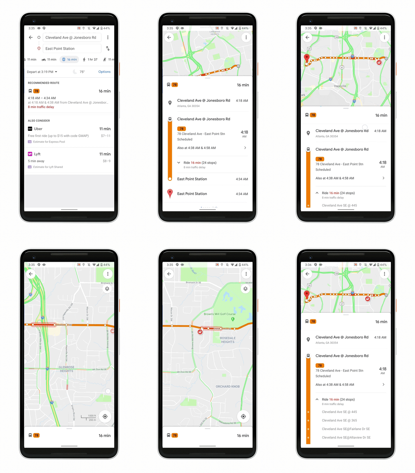
Google Maps. Informatiile privind aglomeratia din mijloacele de transport in comun sunt afisate in aplicatie doar in momentul in care se creeaza o ruta bazata pe ele, si se acceseaza informatii detaliate despre acea ruta. Puteti vedea in imaginea de mai sus cum arata sistemul pe care Google Maps il ofera pentru utilizatorii din lumea intreaga, insa deocamdata nu si pentru Romania, dar ar putea aparea date inclusiv pentru noi intr-un viitor nu foarte indepartat.
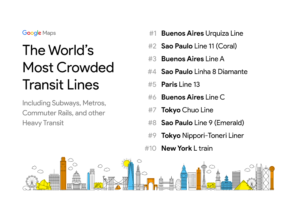
Google Maps. Multumita datelor adunate, compania Google a creat si un top al oraselor cu cele mai aglomerate mijloace de transport in comun, iar Buenos Aires ocupa prima pozitie, dupa cum puteti vedea. Practic, Google Maps devine din ce in ce mai buna pentru ajutarea utilizatorilor sa mearga oriunde doresc, in conditiile in care doresc, iar aceasta este o veste foarte buna pentru toata lumea, chiar daca functia nu e inca disponibila peste tot.


