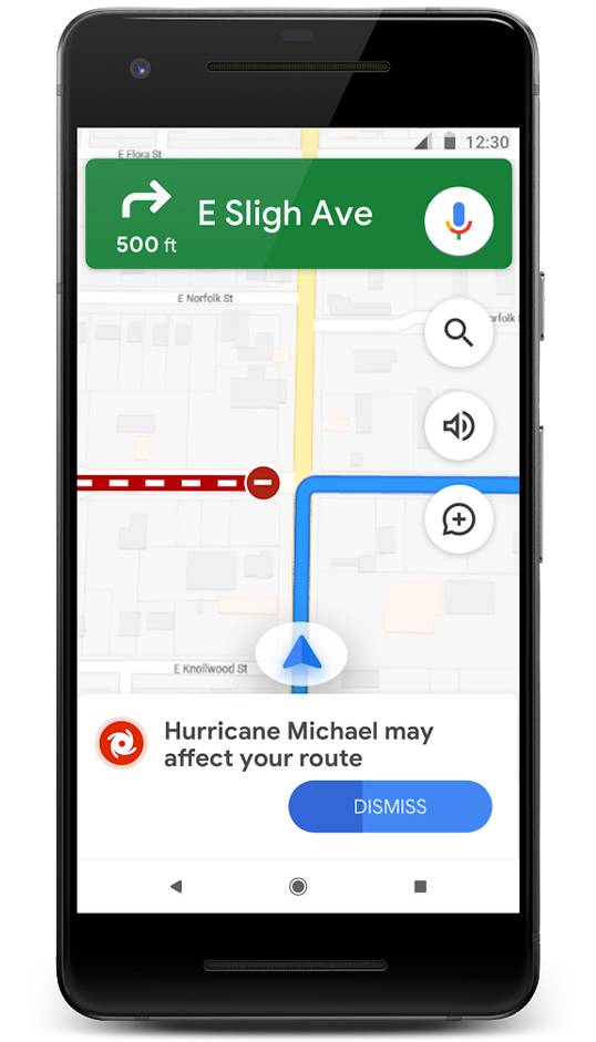
Google Maps are parte de cateva functii noi, foarte importante, lansate astazi de catre compania Google, si vorbim despre schimbari care ne-ar putea salva si viata, in situatiile limita in care ar fi nevoie de asa ceva. Mai exact, incepand de astazi, Google Maps afiseaza alerte in timp real pentru situatiile de criza care exista pe rutele noastre, fie ca e vorba despre dezastre naturale, sau alte tipuri de evenimente de care ar trebui sa stam departe.
Google Maps a avut acum doi ani lansata o functie numita Alerte SOS, aceasta afisandu-le utilizatorilor informatii despre evenimente periculoase care exista pe rutele pe care urmeaza sa fie directionati. Functia este imbunatatita astazi cu includerea cutremurelor, a tornadelor, a uraganelor, sau a inundatiilor pe lista evenimentelor pentru care utilizatorii Google Maps vor fi alertati in timp real, pentru a sti sa se fereasca de respectivele zone, cu prioritate.
Google Maps te FERESTE de TORNADE, Ia o Functie a Waze
Google Maps va afisa o alerta precum cea de mai jos pentru utilizatorii care urmeaza sa ajunga in apropierea unui dezastru natural, iar in aceasta situatie, utilizatorilor li se va face si o ruta ocolitoare, pentru a ajunge in siguranta unde vor. In cazul dezastrelor, utilizatorii vor putea vedea si in aplicatie informatii despre evenimentul respectiv, astfel incat sa nu mai fie nevoiti sa caute informatii pe diverse website-uri, sau aplicatii, si sa piarda timp care i-ar putea costa viata.
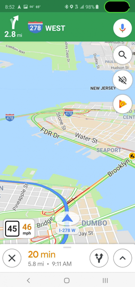
Google Maps are implementata deasemenea o functie luata de la Waze, care afiseaza in timp real viteza de deplasare in timpul calatoriilor, aceasta fiind calculata folosind GPS-ul din telefoane. Aplicatia va afisa deasemenea si limita de viteza din anumite zone prin care calatorim, astfel ca vom sti daca depasim limita legala, sau daca putem circula fara probleme, la viteza noastra, dar e intotdeauna cel mai bine sa va uitati dupa indicatoarele de viteza de pe drum.
Google Maps are implementate aceste functii acum, si distribuite la nivel global, dar va trebui sa mai avem rabdare pana cand totul va deveni disponibil pentru utilizatorii din diverse zone de pe glob.


