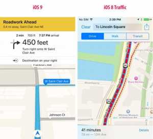
Conform informatiilor oferite de catre Apple, in iOS 9 Apple Maps va putea oferi navigare ghidata pentru rutele de transport in comun si aici ma refer la autobuze, trenuri, sau linii de metrou, doar 10 orase de pe glob urmand a avea disponibile informatiile acestea.
Pentru ca noua functie a iOS 9 urmeaza sa fie utilizata de un numar mare de persoane, compania americana a actualizat pagina in care ofera detalii despre ea si listeaza acum inclusiv partenerii care ii ofera toate datele pentru sistemul de navigare ghidata pentru rutele de transport in comun.
Conform Apple, nu mai putin de 20 de surse de informatii sunt folosite pentru acest sistem, in anumite orase existand o singura sursa de date, in timp ce in altele exista cate 3 surse de informatii, Flixbux, Metrolinx si MiWay numarandu-se printre partenerii celor din Cupertino.
Separat, Positron Technologies si DAC Group ofera acum informatii pentru business-urile afisate in Apple Maps, Yext fiind singura companie care le furniza pana in prezent, astfel ca acum ar trebui sa vedem mai multe tipuri de afaceri prezente in aplicatia din iOS.
Conform celor de la Apple, noul serviciu de navigare ghidata pentru rutele de transport in comun urmeaza sa fie disponibil uin urmatoarele orase dupa lansarea oficiala a iOS 9 : Baltimore, Berlin, Chicago, Londra, Mexico City, New York City, Philadelphia, San Francisco, Toronto si Washington DC.
Avand in vedere ca pentru iOS 9 Apple Maps Apple a implementat un nou sistem de actualizare a hartilor, acum compania poate oferi actualizari mai usor prin internet fara a mai actualiza intregul sistem de operare, asa ca noi orase pot fi adaugate rapid, fara efort.


